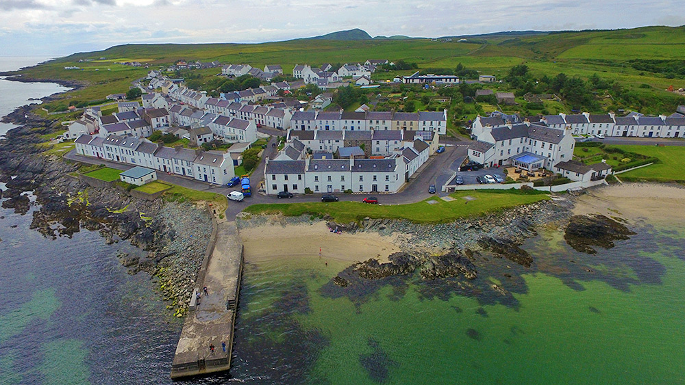
A view of the centre of Port Charlotte from a drone above Loch Indaal. Shore Street in the front with the Port Charlotte Hotel on the right. Also Beinn Tart a’Mhill visible in the distance, the highest hill on the Rhinns of Islay.

A view of the centre of Port Charlotte from a drone above Loch Indaal. Shore Street in the front with the Port Charlotte Hotel on the right. Also Beinn Tart a’Mhill visible in the distance, the highest hill on the Rhinns of Islay.

A couple of months after the flight over Port Charlotte, getting ready for another flight over the Rhinns of Islay, this time at Bruichladdich, in particular the distillery. The camera was still a GoPro, although the drone had gained some propeller guards and foam to soften the landings. This video of Bruichladdich from the air was the result. Still a bit shaky and wobbly, but that was all we had back then.
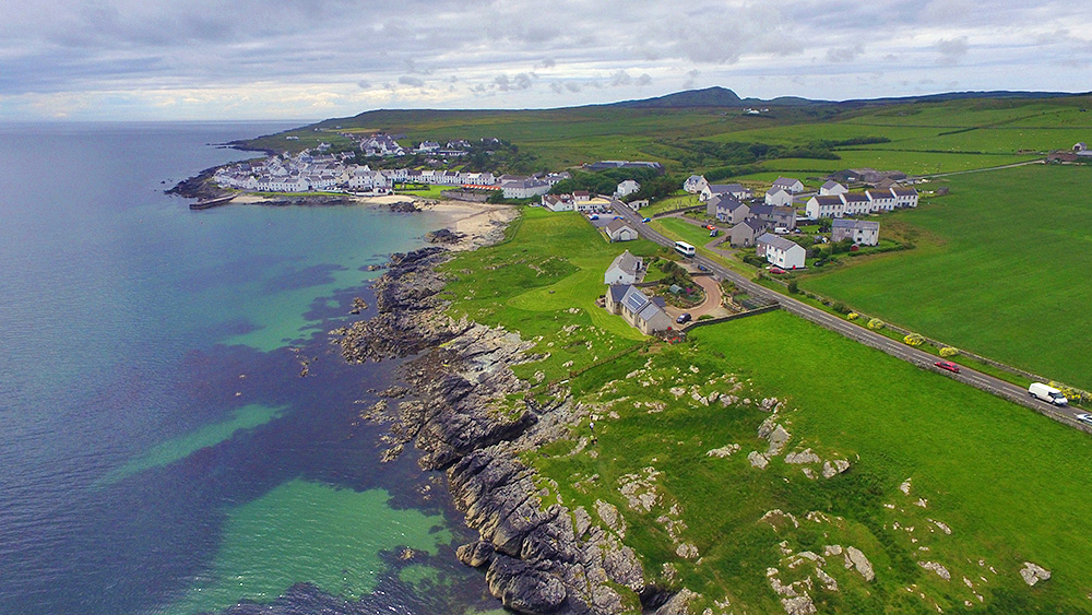
A drone view of Port Charlotte on the Rhinns of Islay, approaching along the coast from the Loch Indaal lighthouse. Port Charlotte pier visible on the left. A Mundell coach approaching the village from Bruichladdich, passing on its way to Portnahaven. Beinn Tart a’Mhill (232m) in the distance.